

Soal UAD ANT II Penentuan Posisi
My courses UADN2 UAD, Kamis 6 Agustus 2020 Soal UAD ANT II Penentuan Posisi
Started on Thursday, 6 August 2020, 8:00 AM
State Finished
Completed on Thursday, 6 August 2020, 8:59 AM
Time taken 58 mins 33 secs
Marks 27.00/30.00
Grade 9.00 out of 10.00 (90%)
2. The positions of the ship provided by the GPS should always be confirmed by other means, when possible. Which of the following suggested methods would be the most accurate?
Select one:
a. Bearing using the Radio Direction Finding of three radio beacons
b. Compass bearings of three shore objects
c. The ranges of three distinctive shore objects on the radar.
d. Bearing and distance from a navigational Buoy
26. Which position includes the effects of wind and current?
Select one:
a. Set position
b. Dead reckoning position
c. Estimated position
d. Leeway position
25. Your longitude is 179°59’W. The LMT at this longitude is 23h 56m of the 4th day of the month. Six minutes later your position is 179°59’E longitude. Your LMT and date is now __________.
Select one:
a. 00h 02m on the 4th
b. 00h 02m on the 6th
c. 23h 50m on the 5th
d. 00h 02m on the 5th
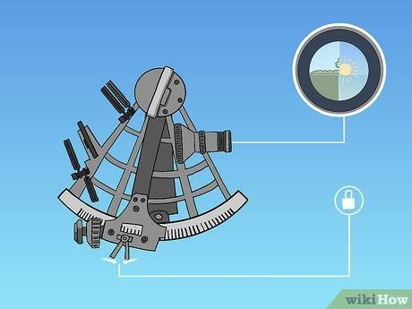
46. Bagian dari sextant yang dipasang langsung di atas pivot dari lengan indeks adalah __________.
Select one:
a. B. kaca cakrawala
b. D. Teleskop
c. cermin indeks
d. C. drum mikrometer
41. Untuk menentukan posisi dengan sudut sextant tegak terhadap suatu ketinggian suar didepan tepi langit maka pada saat mana yang dianggap benar :
Select one:
a. Pada saat air tengah-tengah
b. Pada saat air rendah
c. Semua di atas benar
d. Pada saat air tinggi.
28.The time interval between the transmission of signals from a pair of Loran-C stations is very closely controlled and operates with __________.
Select one:
a. An atomic time standar
b. Eastern Standard Time
c. Daylight Savings Time.
d. Greenwich Mean Time
35.Untuk menentukan nama bintang yang tidak dikenal maka unsur – unsur berikut harus dipenuhi :
Select one:
a. LHA* , SHA* dan Deklinasi
b. GHA* SHA* dan Deklinasi
c. SHA*, Deklinasi dan Sebutan Deklinasi.
d. SHA* , GHA* dan Sebutan Deklinasi.
31. Bila memungkinkan , rencana DR harus dimulai dari mana ?
Select one:
a. Bukan dari salah satu di atas
b. Sembarang Posisi apapun
c. Posisi yang diasumsikan
d. Posisi yang dikenal
29. The difference in local time between an observer on 114°W and one on 119°W is __________.
Select one:
a. 5 minutes
b. 20 minutes
c. 1.25 minute
d. 75 minutes
22. A single line of position combined with a dead-reckoning position results in a(n)____.
Select one:
a. Assumed position
b. Estimated position
c. Fix
d. Running fix
16. While steering a course of 150°T, you wish to observe a body for a latitude check. What would the azimuth have to be
Select one:
a. 150°T
b. 000°T
c. 090°T
d. 240°T
32. Peta dengan skala 1: 160.000 digolongkan sebagai __________.
Select one:
a. Peta pantai
b. Peta pelabuhan
c. Peta umum
d. Peta Berlayar
30. A position that is obtained by applying estimated current and wind to your vessel’s course and speed is a(n) __________.
Select one:
a. Dead reckoning position
b. Fix
c. None of the above
d. Estimated position
37. Garis posisi Loran C berbentuk :
Select one:
a. Direct Line
b. Tidak ada yang benar.
c. Serkuler
d. Hyperbola,

38. Jika ketiga garis posisi membentuk cookedhat, dimana posisi yang sebenarnya
Select one:
a. Semua yang disebut diatas
b. Didalam cockedhat
c. Mungkin diluar atau didalam cockedhat
d. Diluar cockedhat
44. Bintang kutub terletak pada rasi
Select one:
a. @ ursae minoris
b. @ Ursae majoris
c. Big Bear
d. Tidak ada pilihan
19. A position obtained by taking lines of position from one object at different times and advancing them to a common time is a(n) __________.
Select one:
a. Estimated position
b. Dead-reckoning position
c. Fix
d. Running fix
40. Untuk menentukan posisi dengan sudut sextant tegak terhadap suatu ketinggian suar didepan tepi langit maka pada saat mana yang dianggap benar :
Select one:
a. Semua di atas benar
b. Pada saat air tinggi.
c. Pada saat air rendah
d. Pada saat air tengah-tengah
43. Kesalahan garis tinggi yang nilai dan tandanya selalu sama untuk setiap observasi, atau dapat dikatakan prosentasi yang sama misalnya :
Select one:
a. Semua yang di atas benar.
b. Kesalahan karena lupa menjabarkan koreksi indeks sextant.
c. Kesalahan pada ptlm.
d. Kesalahan pribadi navigator (ketajaman mata )
27. The GHA of the first point of Aries is 315° and the GHA of a planet is 150°. What is the right ascension of the planet?
Select one:
a. 7 hours
b. 19 hours
c. 11 hours
d. 23 hours
3 Is important to check when transferring a position from the GPS output to a paper chart?
Select one:
a. Any necessary corrections are applied to convert between the GPS datum and the chart datum
b. Ensure that the GPS is setup on the same datum as the chart.
c. Ensure that the chart has been corrected up to date.
d. It is important to ensure that the GPS is setup on 2 dimensional and not 3 dimensional position fixes.
34. Rumus umum tinggi hitung :
Select one:
a. Sin th = Cos ( L ± Z) – Cos L x Cos Z x Sinv P
b. Sin th = Cos L – Cos Z – Cos L x Cos Z x Sinv P
c. Sin th = Cos Z – Cos L – Cos L x Sin Z x Sinv P
d. Sin th = Cosl ( L- Z) – Cos L x Cos P x Sinv P
23 The rate of increase in hour angle is the slowest for –
Select one:
a. The Moon
b. Mercury
c. Mars
d. The Sun
33.Intercept (p) adalah
Select one:
a. Selisih tinggi sejati dengan tinggi hitung
b. Selisih tinggi menurut sextant dengan tinggi ukur.
c. Selisih tinggi sejati dengan tinggi ukur.
d. Selisih tinggi ukur dan tinggi hitung
18. The LMT of LAN is 1210. Your longitude is 70°30’E. Which time would you use to enter the Nautical Almanac to determine the
declination of the Sun at LAN?
Select one:
a. 1652
b. 0728
c. 1842
d. 065
42. Kesalahan garis garis tinggi yang dilukis dapat disebabkan kesalahan waktu .Jika kesalahan waktu yang dipakai adalah lebih besar dari waktu sebenarnya maka garis tinggi digeser sebesar kesalahannya ke arah :
Select one:
a. Ke Utara
b. Ke Selatan
c. Ke Barat
d. Ke Timur
17. For navigational purposes, each great circle on the Earth has a length of ———–.
Select one:
a. 5,400 miles
b. 3,600 miles
c. 21,600 mile
d. 12,500 miles
13.The names of planets used in ship navigation
Select one:
a. Vanus, Mars , Jupiter , Saturnus
b. Uranus, Mercurius , Jupiter , Saturnus
c. Venus, Mercurius, Uransu , Saturnus,
d. Mercurius, Mars . Jupiter, Saturnus,
20. The parallax angle will vary the most with the time of year for __________.
Select one:
a. Venus
b. Polaris
c. Saturn
d. Jupiter
36. Untuk menentukan matahari ada di meridian atas maka azimut matahari
Select one:
a. 090° T.
b. 270° B
c. 180°
d. 000°

Nilai 9.33 dari 30 soal 1. Kombinasi antara komputer analog dan digital disebut : b. Komputer hybrid 2. Kalkulator yang mengandung teknologi tinggi dan disebut sebagai komputer saku adalah : b. Komputer digital 3. Komputer yang biasa dipakai manusia dalam kehidupan sehari-hari adalah : c. Komputer digital 4. Penggunaan komputer sebagai alat pembelajaran dikenal sebagai …
My courses UADN2 UAD, Senin 10 Agustus 2020 Soal UAD ANT II Kepemimpinan Etos Kerja dan Manajerial Started on Monday, 10 August 2020, 10:31 AM State Finished Completed on Monday, 10 August 2020, 10:43 AM Time taken 11 mins 57 secs Marks 30.00/30.00 …

My courses UADN2 UAD, Kamis 6 Agustus 2020 Soal UAD ANT II Penentuan Posisi Started on Thursday, 6 August 2020, 8:00 AM State Finished Completed on Thursday, 6 August 2020, 8:59 AM Time taken 58 mins 33 secs Marks 27.00/30.00 Grade 9.00 out of 10.00 (90%) 2. The positions of the ship …

Materi Pertemuan 21INS & IBS A. Sistem Navigasi Terpadu = Integrated Navigation System (INS) 10.1.Pendahuluan Konsep Dasar : Konsep dasar Integrated Navigation System (Sistem Navigasi Terpadu ) di anjungan adalah suatu konsep sistem terintegrasi ynang mengambil input /masukan dari berbagai sensor dari perangkat di atas kapal yang menampilkan informasi posisi secara eleltronik dan memberikan sinyal …
Institution Name BP3IP Jakarta Date –Assessor Name MUDAHIR Code Item –Study Program 1) DP II PENINGKATANType of Test 2) Multiple Choice Competence/Subject KEPEDULIAN LlNGKUNGAN Bloom Taxonomy 3) C1,C2,C3Level of Competences 4) A N T IINAUTIKA Criteria 5) Difficult/Medium/EasyStandard of Competence A II/2Question 1. What is the Convention for Prevention of PollutionFrom ships :a. Solas …
Marks 47.00/49.00Grade 9.59 out of 10.00 (96%) 13. To maintain good relationship among the crew on board a vessel, one must be:Select one:a. Polite and diplomatic while talking to crew membersb. Strict and authoritative while giving ordersc. Give authority to othersd. Understanding, Co-operative, and have respect from both sides 09. Onboard training should be …
CHAPTER III Life-saving appliances and arrangements PART A-GENERAL Regulation 1 Application 1 Unless expressly provided otherwise, this chapter shall apply to ships the keels of which are laid or which are at a similar stage of construction on or after 1 July 1998. 2 For the purpose of this chapter the term a similar …

SOLAS 1974 CHAPTER XI-2 SPECIAL MEASURES TO ENHANCE MARITIME SECURITY Regulation 1 Definitions 1. For the purpose of this chapter, unless expressly provided otherwise: 1. Bulk carrier means a bulk carrier as defined in regulation IX/1.6. “Bulk carrier means a bulk carrier as defined in regulation IX/1.6. ADFINES NORTH This …
Beberapa Materi yang akan di uji dalam kaitannya dengan ujian negara untuk mendapatkan sertifikat Operator radio umum Mualim REOR diantaranya: Bahasa Inggris GMDSS Peraturan Radio Perjanjian Internasional Servis Dokumen Tekhnik Radio Telephony Radio Ujian Operator radio umum Mualim terdiri dari Ujian praktek dan teori Untuk ujian Praktek akan di selenggarakan oleh lembaga diklat dengan beberapa …
USE OF LEADERSHIP AND MANAGERIAL
What is “cargo plan”. When applied to a ships A discussion between the shore and ship to plan the procedure for loading cargo Notices to marine _________ carefully and regularly to avoid grounding Should be studied Wreck sand rock are not easily _________ by the signal Detected To help the preparations to leave the …

Bagian ini akan menjadi sesi tanya jawab, menggunakan model, papan magnetik dan situasi real-time berbasis komputer atau simulator. Trainee harus sudah benar-benar memahami COLREGS dan aplikasinya, jadi sesi ini akan menjadi keperluan revisi dan konsolidasi. Jawaban “panggil Nakhoda” tentu saja tidak lagi tersedia bagi mereka. Perhatian peserta pelatihan harus diarahkan pada kasus tubrukan dan putusan …
Berthing 1. General .1. Is/are the propeller(s) clear?.1.1. Yes, the propeller(s) is/are clear..1.2. No, the propeller(s) is/are not clear..1.3. Keep the propeller(s) clear. .2. Are fenders on the berth? .2.1. Yes, fenders are on the berth..2.2. No, fenders are not on the berth..3. Have fenders ready fore and aft. .2. Berthing.1. We will berth …


Comments are not available at the moment.